Embedded Files

Weed Reports
Weed Reports
Weather data
Weather data
See the CLA Weather Station page
This data is recorded every minute continually.
Archive of archive of charts and numbers
It is available in logger form here updated every 5 minutes (data is 15 minute delayed), and going back to the beginning of recording: weather log
Water inlets to the lake
Water inlets to the lake
There are ongoing efforts to monitor the water quality entering Countryside Lake. A Water Monitoring Committee was formed.
Data was originally collected around the time of the large Toll construction across from Gilmer road in 2002-2005.
It was deemed likely that they were causing detriment to the Indian Creek inlet. CLA subsequently started a broad program of monitoring water inlets for various factors.
A lawsuit ensued with Toll Brothers, but was ultimately settled with the IEPA and State of Illinois.
Extensive data was collected over several years with sampling equipment, and data loggers around the area.
Water sampling of the inlets to the lake
Water sampling of the inlets to the lake
There were ongoing efforts to monitor the water quality entering Countryside Lake. A Water Monitoring Committee was formed.
Data was originally collected around the time of the large Toll construction across from Gilmer road in 2002-2005.
It was deemed likely that they were causing detriment to the Indian Creek inlet. CLA subsequently started a broad program of monitoring water inlets for various factors.
A lawsuit ensued with Toll Brothers, using some of this data, but was ultimately settled with the IEPA and State of Illinois.
Extensive data was collected over several years with sampling equipment, and data loggers around the area.


Obstructions
Obstructions


FEMA 100 Year Flood

Wetlands

Dredging Proposal of 2001
Dredging Proposal of 2001
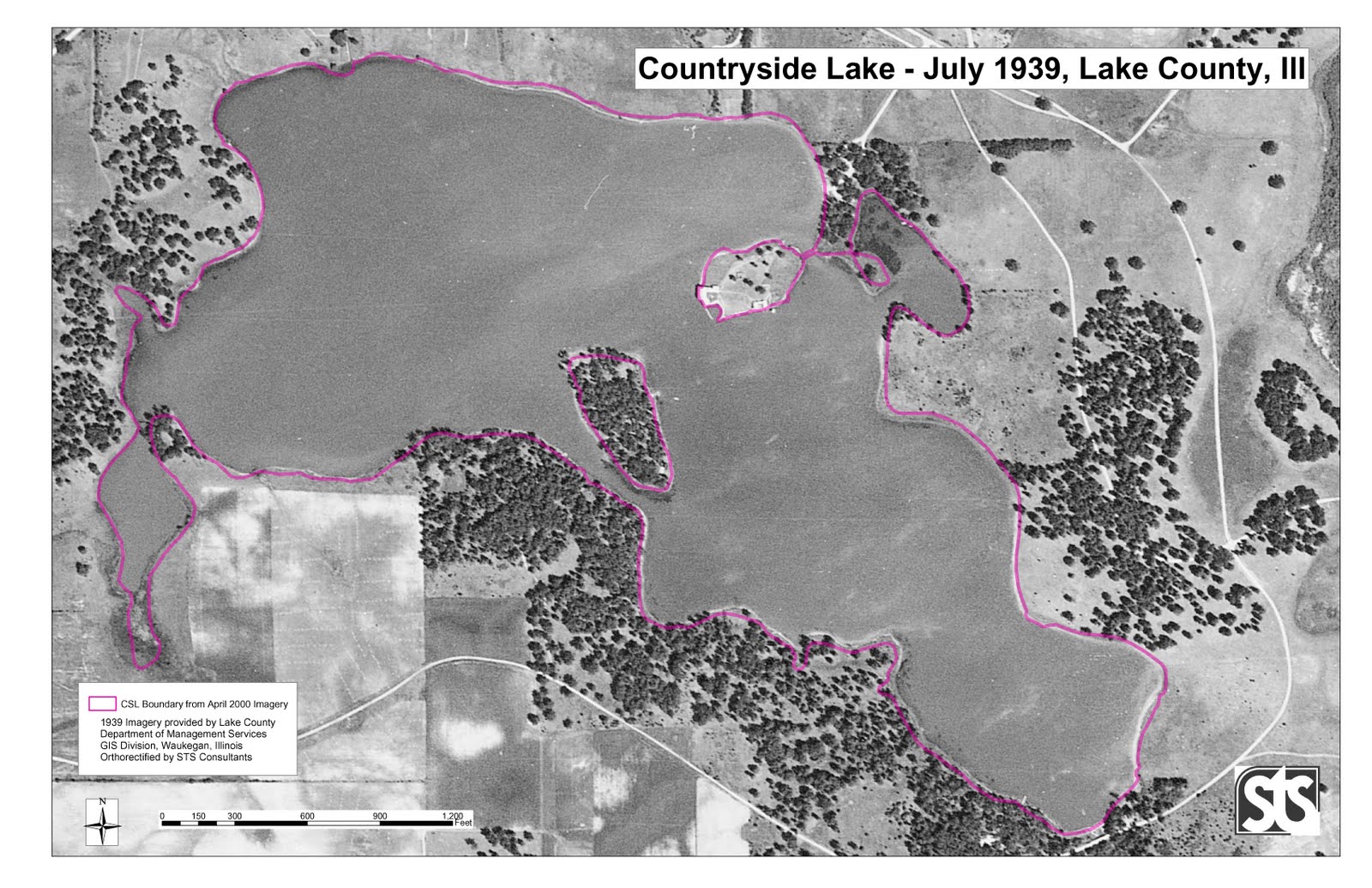
1939 photograph overlaid with 2001 shoreline
photograph overlaid with indication of observed erosion in 2000

Recommendation from the Dredge Committee

Aerial Photographs
Aerial Photographs
See the historical aerial photographs.
Page updated
Google Sites
Report abuse